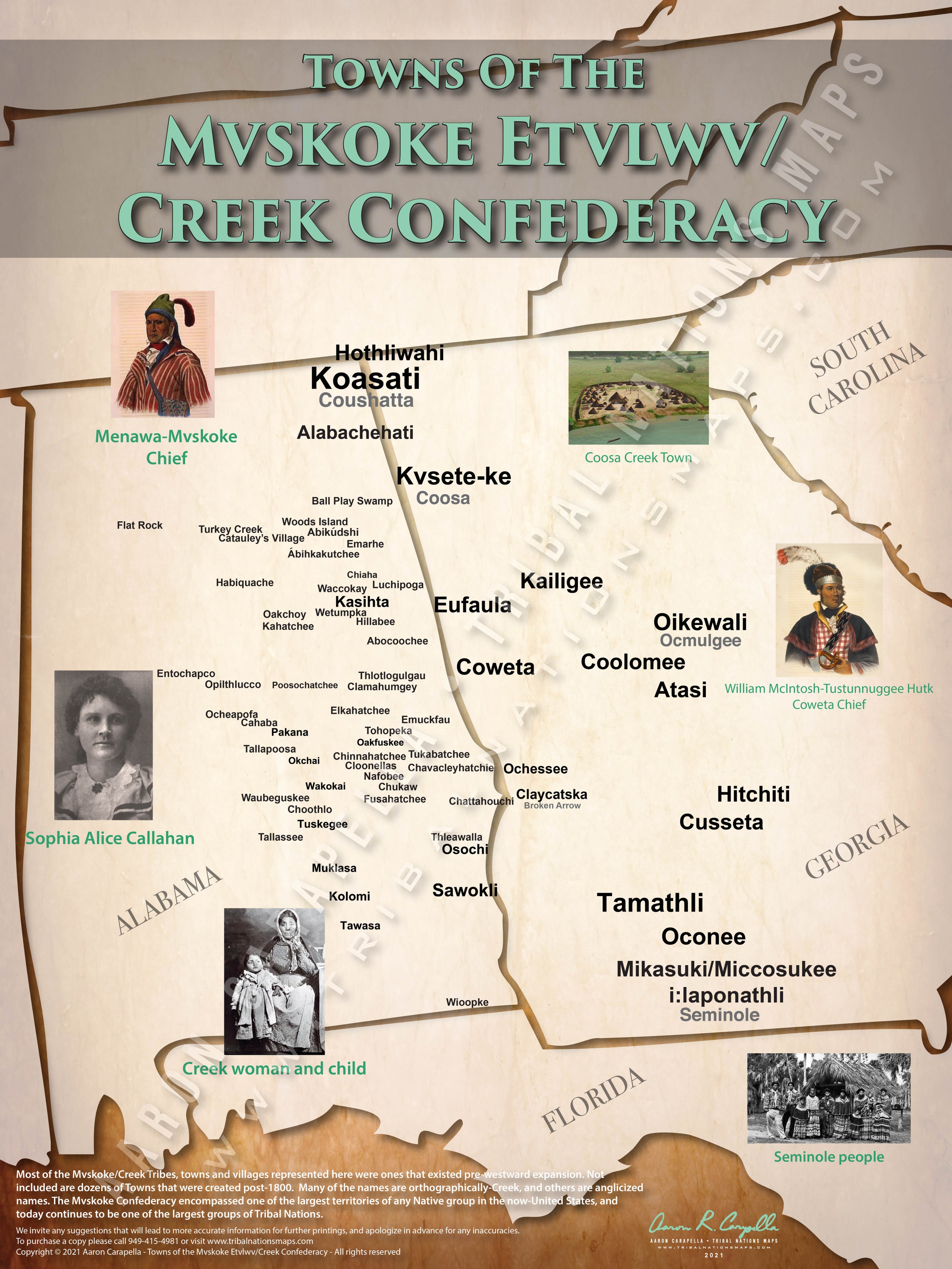
Towns of the Mvskoke Etvlwv/Creek Confederacy - 18"x24"
SKU:
$49.00
$49.00 - $250.00
per item
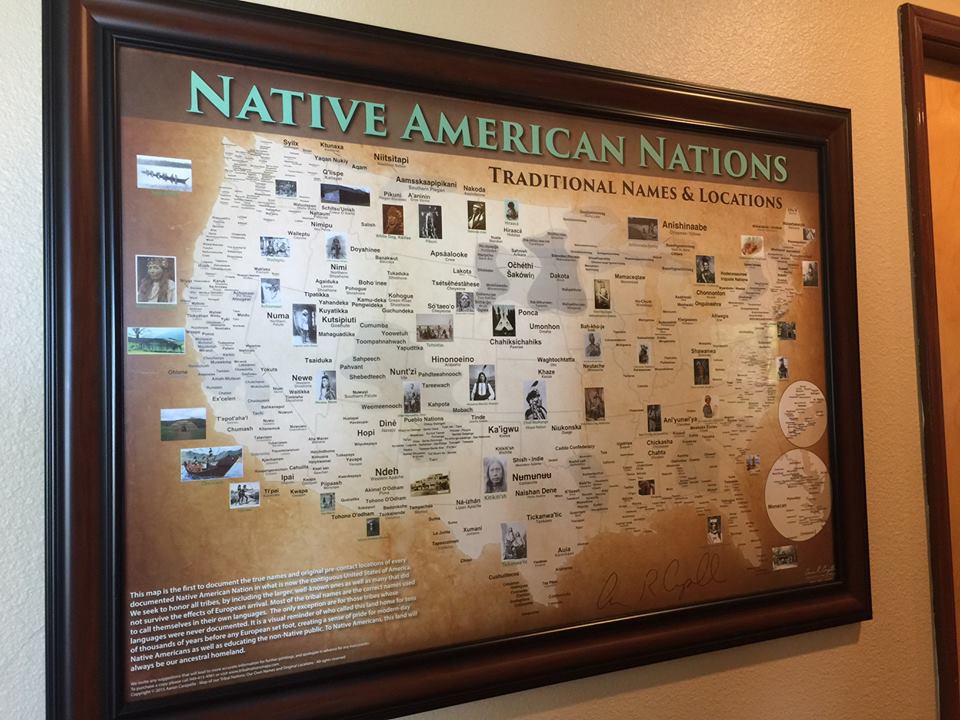
Most of the Mvskoke/Creek Tribes, towns and villages represented here were ones that existed pre-westward expansion. Not included are dozens of Towns that were created post-1800. Many of the names are orthographically-Creek, and others are anglicized names. The Mvskoke Confederacy encompassed one of the largest territories of any Native group in the now-United States, and today continues to be one of the largest groups of Tribal Nations.